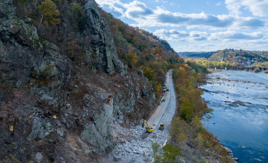


Work undertaken on the stretch of road included stabilising the corridor through rock slope scaling, removal of rockfall hazards, and localised rock bolting.
The crews also repaired pavement and guardrail that was damaged from falling rock and installed draped and pinned mesh, ground-level rockfall barriers, and on-slope rockfall attenuator systems to reduce future rockfall events and safely catch any rocks that may fall. The West Virginia Department of Highways (WVDoH) also sealed the deck on the bridge over the Shenandoah River and repaired two slips on Chestnut Hill Road.
"We understand the historical significance of the area and the importance of this corridor in connecting West Virginia, Virginia, and Maryland - and were thrilled to partner with Triton Construction to bring our technical abilities in rockfall mitigation to the project. Together, our crews demonstrated an unwavering commitment to creating a safer US 340, while sticking to timelines and budget constraints," Brian McNeal, VP of Service Delivery, Access Limited Construction, said. "We were even able to wrap up the project and re-open the roadway 10 days ahead of schedule, contributing to a reduction of 770t of carbon emissions from diverted traffic."
US 340 along the Shenandoah River is a main route through Jefferson County, West Virginia, and experiences an estimated 24,500 vehicles a day - including local, commuter, and truck traffic from West Virginia, Virginia, and Maryland. The route also receives high traffic from seasonal tourism due to the history of Harper's Ferry and the recreational activities within the National Park. In response to the high traffic volume and signs of erosion in the cut slopes and the exposed natural slopes, the WVDoH conducted a design study to determine threats to public safety. The slopes in the project study area - which vary in height from 150ft to greater than 300ft above the roadway - had varying degrees of rockfall activity that presented potential hazards to area travellers and called for mitigation needs.